Sallie Barber Hike
Sallie Barber Hike
Note: Before hitting the trails, read Preston’s Tips to make sure you’re ready for hiking in the High Country.
This week we return to French Gulch for a nice hike to a wonderful interpretive site that Breck History stabilized a few years ago: the Sallie Barber mine.
For our first hike we started at the west end of French Gulch, hiking from the B&B Trailhead to the Reiling Dredge. This week we’ll start by driving past the Reiling Dredge to Lincoln City and the Lincoln City trailhead.
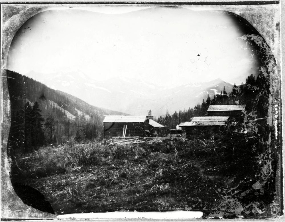
Log cabins at Lincoln City in 1862. Gift, Montana Historical Society. Breckenridge History.
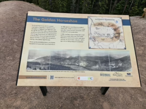
Lincoln City, like Preston, was a small community that sprung up during the late 1800s in the Golden Horseshoe area just east of Breckenridge. Farncomb Hill and the Wirepatch Mine (where Tom’s Baby was found) are just past the Trailhead on the north side of the stream. (Side note: my neighbor’s family has lived in the area for a long time with her grandmother having been born in Lincoln City.)
 To start our hike we will continue up the road, bearing right past two vehicle gates until we cross over there stream. The first two left turns would take us up Humbug Hill where the top of the Wirepatch Mine provides wonderful views of French Gulch. Continuing over the ridge would take us over to the northern half of the Golden Horseshoe while the main road continues up French Gulch, between Bald Mountain and Mt. Guyot to French Pass into Park County and the town of Jefferson.
Past the stream the road turns in a southeastern direction and starts a long slow climb to the mine via the original mine road. Since this side of the Gulch faces north we’ll be hiking among evergreens all the way to the top. Use the occasional breaks in the trees to look across French Gulch at other mine sites (marked by tailings dumps) and note that they also have gently sloped roads leading to them. The first 1/3 of the climb we’ll have water for the dogs flowing down next to us. Partway up, on the right, the Turks Trail will terminate on our road. Those who are interested in a longer September leaf peeping hike can park at the B&B Trailhead, hike to the Reiling Dredge, continue up the B&B trail to the Turks Trail, and join the Sallie Barber road up to the mine (returning by continuing on the road to the Barney Ford trail and the V3 trail).
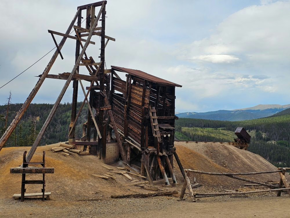
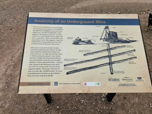
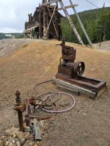 Up at the top of the road is the Sallie Barber mine site, which opened in the 1880s and was worked intermittently into the 1940s. Interpretive signs show how the mine consisted of three levels and a sump down at 365′. During Breck History’s stabilization project, equipment found on-site was used to illustratively reconstruct how operations were powered by a steam plant, a storage tank, and a steam hoist which operated a cable that ran over the sheave at the top of the headframe to lower ore buckets into the mine and pull ore up where it would be dumped into the ore bin, if high quality, or dumped on the hillside tailings dump via an ore car. There is also a on-site, belt-driven air compressor connected to an example of a rock drill. Be sure to step up to the headframe and look down through the grate into the mineshaft.
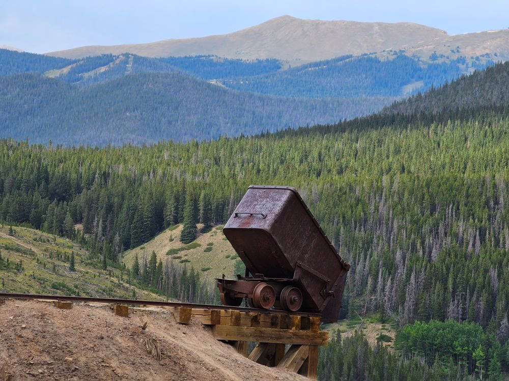
The views from the mine site are spectacular, with the top of the Wirepatch Mine being just visible over the shoulder of Bald Mountain to the east. Lincoln Park and Mineral Hill are directly across French Gulch. And while you can’t see it from the mine, the Reiling Dredge lies directly below the Sallie Barber mine.
I hope you enjoy this hike. It is one of the best interpretive sites around.
Preston