The Ten Mile Range and the Camp Hale-Continental Divide National Monument
March 24, 2023 | Category: Making History Happen
Softly undulating along Breckenridge’s western horizon, the Ten Mile Range marks the boundary of the Upper Blue River Valley. Towering above the town of Breckenridge, iconic Peak 8 is as immediately recognizable as the Matterhorn is to Zermatt or Mount Rainier is to Seattle. Recently protected as a National Monument by President Joe Biden, much of the Ten Mile Range will continue to appear as it did in the mining heyday. Read on to explore the significance and background of Summit County’s Ten Mile Range.
In the early days of Western exploration, map-making was big business. Pioneers seeking an overland route along the Oregon Trail in the 1830s needed guidance. Soon, explorers ventured beyond the established trail to probe further into the western interior
One of the first private citizens to explore and map the area that became Summit County and Breckenridge was writer and mountain man, Rufus Sage. Following in the footsteps of J.C. Fremont’s topographical engineers, in 1844 Sage traveled from Old Park (today’s North Park), over Muddy Pass to the Colorado River and followed a southern tributary, today’s Blue River. Sage gave us the name and location of a mountain man rendezvous point, “La Bonte’s-hole,” at the confluence of the not-yet-named Blue, Snake and Ten Mile Rivers. Yet, like Fremont, he did not record the names of the rivers nor the ranges. What lay west beyond the Ten Mile Range remained a mystery.
The Pikes Peak or Bust gold rush of 1859-60 created demand for more specific maps of the gold regions. In February 1860, the Western Mountaineer, a fledgling newspaper based in Golden, Jefferson County, published one of the earliest guides to identify Breckenridge. A simple hand-drawn map, laid out with west at the top – just as a prospector arriving from the eastern plains would see it – showed a prominent trail. Leading from today’s Colorado Springs through South Park (known then as Bayou Salade), the trail coursed by Tarryall (eastern side of today’s Boreas Pass), to Fort Jones and Breckenridge. At the top of the map, to Breckenridge’s west, stood an imposing mountain range. Beyond that, the great unknown
Regional historians find great value in this map not for just for what it lacks, but for what it contains. Fort Jones was another moniker for Breckenridge’s Fort Mary B. and the identification of Breckenridge is notable for its spelling.
Searching for gold, prospectors soon ventured beyond the boundaries of the Upper Blue River Valley. By 1862, a map of the Colorado Territory Central Gold Region displaying the name of the first territorial governor William Gilpin, showed “Tenmiles Creek” on the other side of the range from Breckenridge. Likely named because it is about 10 miles from the confluence to the head of the waterway.
The name “Tenmiles Creek” repeated on Frederick J. Ebert’s Colorado Map of 1865 and again in 1866 on a Colorado General Land Office map.
In 1873, the U.S. Geological Survey printed a map identifying Ten Mile Creek and the Ten Mile Peaks, along with Mt. Quandary.
Peak 10’s first appearance on a known map came in 1882.
Historic newspaper accounts tell of the range’s iconic peaks. An article in the Summit County Journal of March 1892 mentions Peak Ten and mining activity in the Ten Mile District. In July 1895, a group of guests from Oklahoma and Missouri climbed Peak Ten “and greatly enjoyed the experience and scenery as viewed from the top.”
Several years later, in August 1903, a large party of ladies and gentlemen climbed Peak 10, each carrying a “lunch box and a Kodak.” (We wish we could see those photos!) In 1906, two couples married on Peak 10 in a tent erected near timberline.
Climbing Peak 8 also became a popular leisure-time activity. In 1903, a party of young people ascended Peak 8 and “had the usual interesting mountain climbers’ time.” In 1906, observers noted 5,000 sheep grazing on Peak 8.
Also in 1906, the local newspaper acknowledged Peak 7. A Decoration Day remembrance (today’s Memorial Day) took place at Valley Brook Cemetery, “a beautifully sequestered spot at the foot of snow-capped Peak 7.”
While Peak 10 featured prominently on maps of the late-19th Century, none of the other peaks received names on known maps until after the turn of the century. In 1904, Thomas A. Brown, Breckenridge area miner and map maker, included Peaks 1, 2 and 3 on the north end of the range. On the south, Peak 8 can be found on the bottom edge of the map. Just as we find the lack of distinction between Peaks 4 through 7 confusing today, so did Brown. He declined to identify them by name.
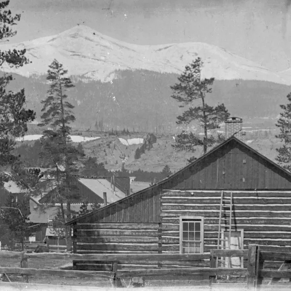
Lacking mineral resources, very few mining claims exist along the eastern face of the Ten Mile Range. With the exception of the Breckenridge Ski Area, the Ten Mile Range looks much as it did during the mining era and Breckenridge’s early history
Because of the historic and natural resources along the mountain peaks, much of the Ten Mile Range is now protected as a National Monument, along with the Camp Hale area where members of the 10th Mountain Division trained during World War II. In October 2022, President Biden established the Camp Hale-Continental Divide National Monument. Setting aside the area and eliminating potential future impacts from mining or extractive industries, Biden cited the following attributes of the areas’ importance:
- Cultural and spiritual significance to Native people, especially the Ute tribe
- Native American artifacts
- Historical remnants relating to mining, transportation and railroads
- Training grounds of the 10th Mountain Division
- Geographic significance of the Continental Divide
- Natural resources including rare plants, abundant water ways, rugged mountains and stunningly beautiful scenery.
Future plans for the area will be determined by a management plan to be established by the US Forest Service with public input.


