Gold Run Loop
Gold Run Loop
Our third hike this season takes us north to the Gold Run area near the Breckenridge Golf Course past a number of locations involved with hardrock lode mining. Our starting point is the Gold Run Trailhead. We’ll be hiking uphill along the Gold Run road to the Preston town site. Gold Run Road was the main road between Gold Run Gulch and Breckenridge on the side of Gibson Hill. The road can be traversed by passenger vehicles with a reasonably capable driver who is able to navigate occasional ruts and rocks. The saddle at the top of the road provides nice views of the Breckenridge north end. The old route can be followed downhill by higher clearance vehicles and terminates in the Wellington neighborhood.
But this entry is about hiking, so from the Gold Run Trailhead, head to the Southeast on a trail to the left of the dirt Gold Run Road. As you head up the trail toward the Jessie Mill, keep your eyes peeled to the right of the trail. About 100 yards before you reach the picnic table at the Jessie Mill, you’ll see numerous collections of rusty cans and broken glass on the right side of the trail. There was a boarding house in this area for the Jessie’s miners and experts have analyzed these midden heaps to better understand the lives, diets, and health issues experienced by miners at the time. Obviously, don’t take any of the artifacts so that future visitors can see them. If you look carefully, you’ll note that some of the glass has turned purple over years of exposure.
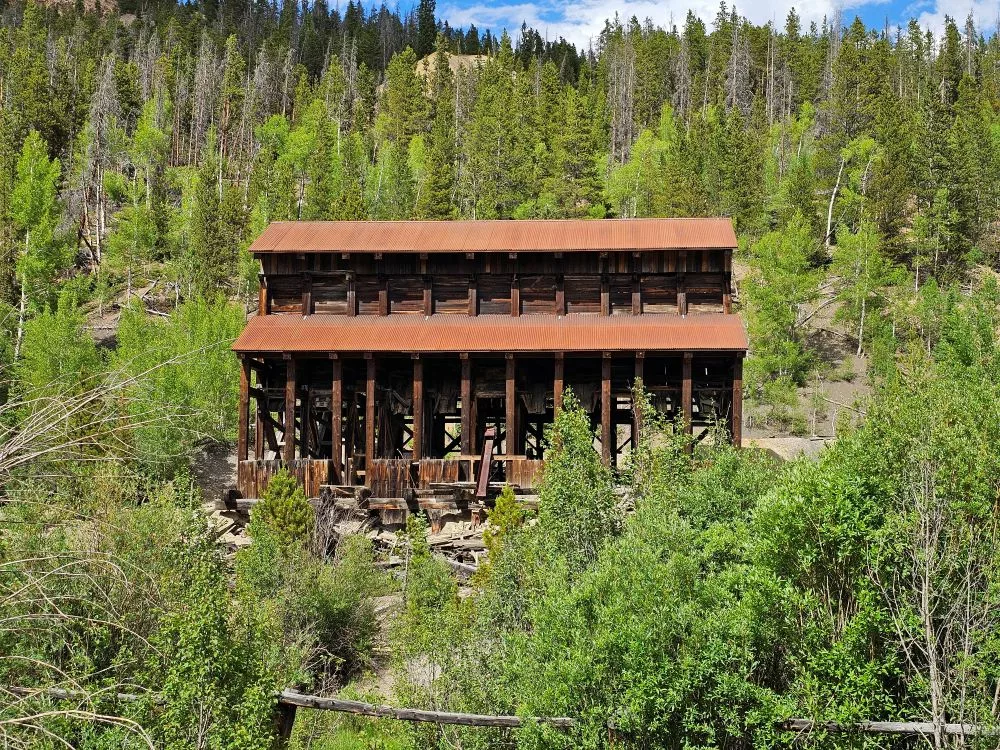
The Jessie Mill is our next stop. The Jessie Mill is one of the best and most easily accessed examples of a former mine and mill site in the greater Breckenridge area. The 1893 wooden stamp mill stands partially intact as evidence of miners’ extensive efforts to recover gold and other minerals from the area. Breck History funded stabilization work here in the summer of 2024 to ensure this structure is still here for many years. Looking at the picture on the sign here, the structure that remains is the ore bins that accepted ore from mine carts and stored it until it was ready to be crushed by rock crusher and stamp mills. The crushers, stamp mills, and subsequent concentration equipment was all housed in buildings between the ore bins and the sign. The actual mine portals were higher on the hill and can be seen from the Jumbo Mine site later in this hike. There IS a road that will take the inquisitive hiker up to the old mine portals but there are chain link fences to discourage access due to the danger of collapse.
Continuing up the Gold Run road, keep your eyes open for wildlife. I’ve personally seen an all-black fox on this road as well as deer and moose in the area. My sharp-eyed hiking partner on this trip also spotted bear tracks in some dried mud.
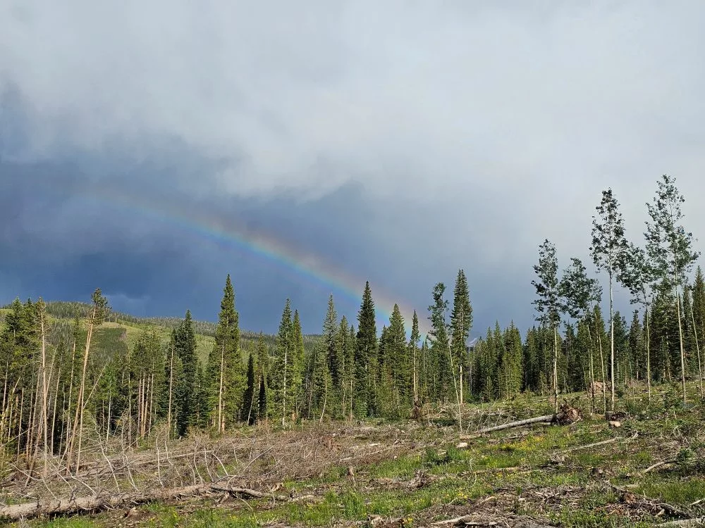
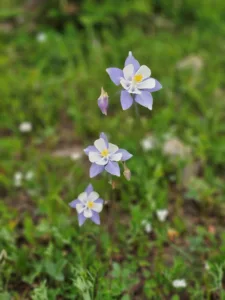 The road will make a right angle turn to head generally west and you’ll come to a large clearing in the forest. When I hiked this trail on July 2 the wildflowers were blooming with columbines, penstemon, potentillas, and others in bloom.
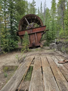
 The next site of interest is on our left and is the Extension Mill site. This mill concentrated the ores from local mines and at one time featured an aerial tramway that brought ore over from the Jumbo Mine for processing. Numerous concrete foundations can be seen and generally were used by heavy machinery like rock crushers, stamp mills, and steam power plants. The most outstanding feature on this site is the large Portand Filter but careful observers will see that there were at least two tanks for liquids on the site (one is in the foreground of the photo below and another is near the back left of the site below a tall shaft that was used to stir a slurry of gold rich ore for chemical extraction of the gold.
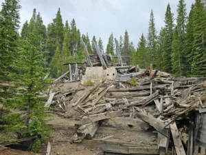
 Dropping back down to the road and continuing uphill we find ourselves in the Preston townsite. The building on the right as you enter town is the Assayer’s office (evidenced by the concrete floor which is typical of an assay facility).
 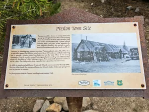 On the left you’ll see the sign for the Preston Town Site. You’ll also see Breck History’s 2025 preservation efforts to restore and preserve 2 of the historic cabins that were in need of some TLC. The town of Preston was short lived (its heydey running from just about 1875 to1890) but it did have a few shops, a post office, and around 150 residents.


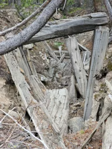
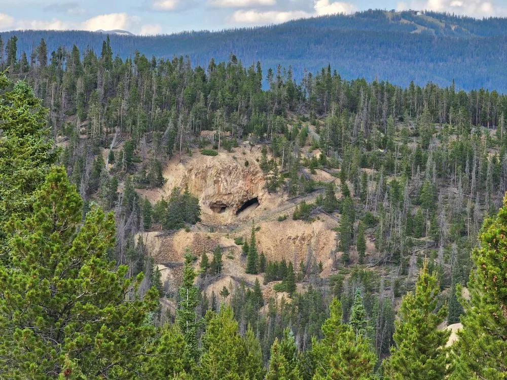
 Continuing west from the two cabin restorations, you’ll shortly come across the ore dump for the Little Corporal mine. If you scramble up the west side of the ore dump you’ll come to the collapsed mine portal which I personally find interesting because you can still see the timber lagging and the first few timber sets what once held up the soil that has since collapsed. You can see exactly how large these timber sets were and maybe even get a feel for the stature of miners in the late 1800s. I peaked at 6′ 2″ and feel that I’d have had to stoop and turn sideways to get through mines of the era.
The large ore dump in front of the mine is composed of waste rock and perhaps low grade ore that wasn’t worth transporting and processing. Everything you see in the ore dump came from underground and passed through the small mine portal that we just visited.
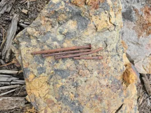 (Note: This picture shows some nails that a recent visitor must have placed on a rock; note that one of the nails is a square nail that would have been made by a blacksmith and not a round machine-made nail)
When you’re ready, head back down the road towards Preston and take a left through the green gate on the Jumbo Road.
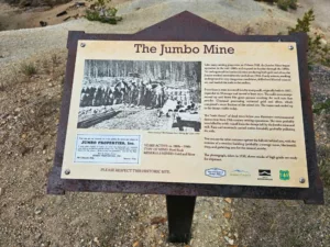 This short road takes us to the Jumbo Mine, one of the Breckenridge area’s more notable mines. The aerial tramway to the Extension mine reportedly ran on the north side of the road. The Jumbo ore dump is significantly larger than the Little Corporal mine, indicating that the mine was worked longer and more intensively. The sign at the end of the ore dump provides additional information and from here you can see the Jessie Mine’s portals across the valley. Below the ore dump you can also see what’s been termed the “Toxic Forest” where plant life struggles to live in the runoff from the ore dump with its heavy metals that leach into the rainwater and snowmelt.
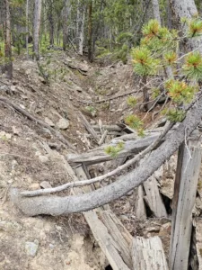
Towards the south end of the site you’ll see the remains of a wooden building that was adjacent to the mine portal. Note how far back into the hillside the mine portal has collapsed and you might get a better appreciation for why we discourage visitors from entering any overhead spaces that could also collapse at a moment’s notice.
When you’ve finished taking in the sights, head back down Gold Run Gulch Road and take a left onto either the Hard Luck trail (near the Assay Office) or the Upper Flume trail. Whichever path you choose, the Upper Flume trail will break into a new meadow with large slash piles and many many wildflowers. You’ll turn right (north) onto the Middle Flume trail and follow it until you reach the Tom’s Baby trail that drops down through the Peabody Placer where hydraulic mining was performed (insert description of Peabody Placer hydraulic mining; I can see that it happened but know none of the details).
That’s it for this installment. I hope you enjoy this scenic loop through the Gold Run area.