Iowa Hill Hydraulic Mining Area
Iowa Hill Hydraulic Mining Area
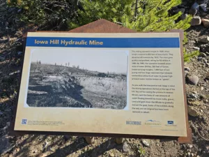
Our second Historical Hike of the season takes you through the Iowa Hill hydraulic mining area and to portions of the trail that most visitors never see.
Iowa Hill started as a series of placer mining claims where miners would use pans, rocker boxes, and long toms to process increasing volumes of gold-containing gravels. Over time these claims were consolidated and funds were invested to improve water supply so that hydraulic mining could be used to efficiently process ever-larger volumes of paydirt.
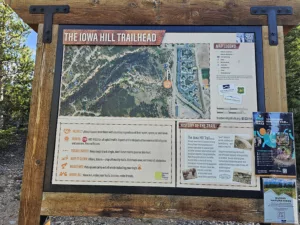
The hike I’ll describe starts from the upper Iowa Hill trailhead off Burro Lane, travels down to the lower Iowa Hill trailhead off of Airport Road, and then returns. Many may find it more convenient to hike up from Airport Road and that works just fine. What’s unique about the path described is that it gives you views of the north ravine that most people hiking the lower loop will never see.
Hydraulic Mining uses massive amounts of water to flush gold-bearing gravels down through sluice boxes where different techniques can be used to recover the gold. The Iowa Hill trail walks you through an excellent series of displays that show the overall process. What’s NOT obvious is the results of mining which flushed tons of silt into the Blue River every day.
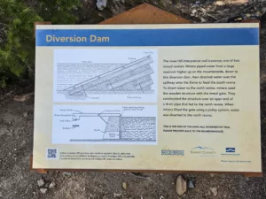 If you’re starting at the Upper Trailhead, the trail will proceed downhill along a series of sweeping banked turns that must be great fun for those on mountain bikes. Your first stop will be at the sign for the Diversion Dam. As you’re hiking down, take note of the large ditch to your left. This ditch provided water to the diversion dam which then sent it along to both the larger north ravine and smaller south ravine. Ditches were used extensively to move water to various mines and are still obvious today if you know to look for them. You’ll see at least three ditches on the course of today’s hike.
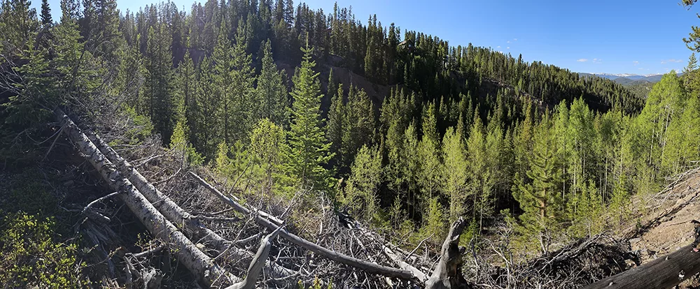
 Continue down the trail to a fork. The right fork is the hiking-only trail and we’ll be returning from that direction. Go left and soon you’ll be on the south rim of the North Ravine. Note that this part of the trail is mixed use so keep an ear open for mountain bikes coming down behind you. Picture this area before mining when there was no ravine here and you’ll get a feeling for just how effective miner’s use of water was to speed erosion in order to collect gold. There are a couple areas where there’s a steep drop to your left, so keep an eye on the little ones. There are a couple of steep sections on the trail as well, so watch your footing.
Continuing down the trail you’ll hit another fork in the road that would take you to the boardinghouse. Stay left and trust that we’ll be coming back to the boardinghouse later in the hike.
 At the bottom of the hill, take another left if you want to drop down to the lower trailhead and read the description of the hike that you’re about to take. (People who are starting from the lower Iowa Hill Trailhead will be starting the trail description here.) Otherwise, stay right and proceed to the next display which talks about the history of Iowa Hill. The next sign then discusses how miners could team up to process more dirt than they could alone.
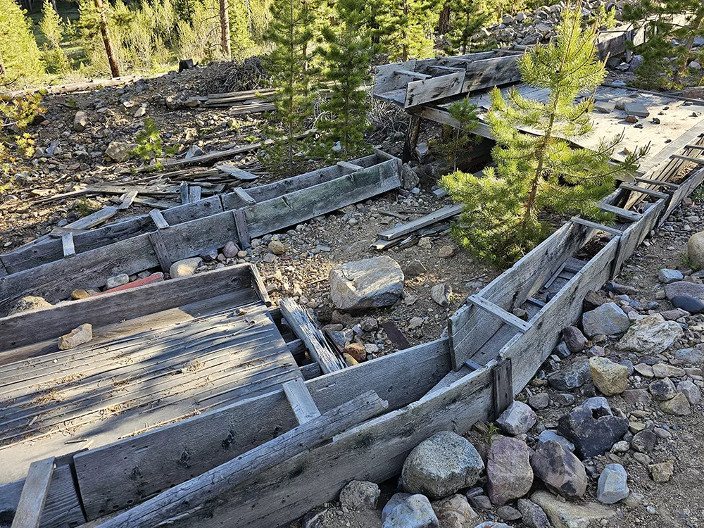
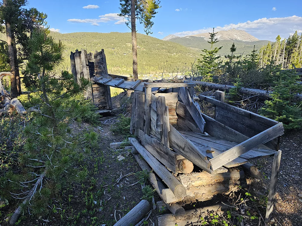
As we hike back uphill, keep in mind that you’ll be seeing parts of the mining process in reverse. The first real display that you’ll come to shows the business end of a long sluice box where an “undercurrent sluice” would separate out gold-bearing silts from the larger rocks and process them more slowly over an amalgamation table and riffles. Mercury was expensive but is still used by some miners today because of its unique properties when exposed to gold. Mercury goes through a process of amalgamation when exposed to gold, thereby providing a means for separating gold from a stream of silty water. The amalgamation of mercury and gold could be scraped up and heated in a retort to separate the gold and mercury again. The health risks of mercury were not well understood at the time.
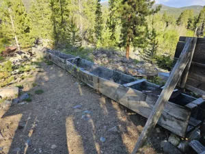 Continuing up the main trail you’ll reach another display that talks about the sluice boxes. The purpose of the sluices with their riffle boards nailed in them was to agitate and break up clumps of dirt so that the gold was in suspension and could be caught by mercury at a riffle or at the bottom by the undercurrent sluice.
 A short distance further up the trail is a short branch to the right that’ll take you to the Guard Station and Blacksmith displays. As operations got larger, miners shifted from being claim owners working their own claim to paid employees working for a company. Miners wages were low and their costs were high, so guards were present at mines to deter “highgrading” or the theft of gold. At Iowa Hill, the guard station had a clear view of the sluices to keep an eye on the miners.
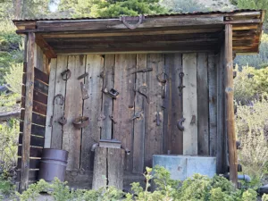
The blacksmithing display shows a number of artifacts discovered at Iowa Hill and explains how a blacksmith was an integral part of every large mining operation. Hydraulic mines used tools, pipes, monitors and other equipment that needed frequent tending lest the mine be shut down to fix issues that got too big.
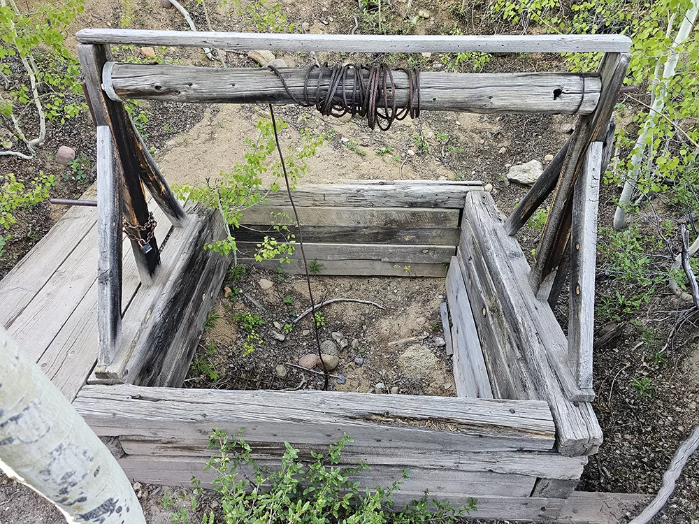
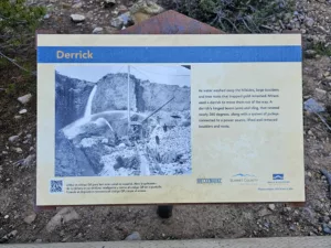 The next displays up the trail teach about Shafting (to help mine operators decide where to focus their efforts) and about how miners would use a simple derrick to move larger objects in their way. There is also a sign that talks about why Iowa Hill was well suited to hydraulic mining.
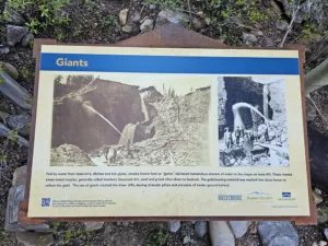 Take a left at the derrick to go a short way uphill for a display about giants and how water pipes could feed water downhill to gain the pressure needed without the use of pumps. Return to the main trail when done.
Continuing our slow upward trek you’ll see a display about Bank Blasting and then cross over another mining ditch on a footbridge. There is a display on the hydraulic mining process and you’ll get your first glimpses of the larger south ravine. You may also notice the work of vandals who ripped a hydraulic monitor (that was fixed in concrete) down from its nice pose. Breck History signs ask users to “Please respect this historic site” because vandals just ruin the experience for everyone around them and increase costs to fix their damage.
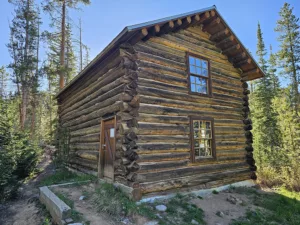 Turning around from the south ravine, you’ll see the Boardinghouse that housed miners working on Iowa Hill. According to a mine site survey conducted by Eric Twitty, the boardinghouse was constructed using cut nails, which indicate it was built prior to the 1890s. In addition, artifacts on site date to the 1870s, and newspaper inside the boardinghouse is from 1876, which could reflect the year of construction.
For those who would like to see the inside of the boardinghouse and artifacts from that time, Breck History offers a Hike Home with a Miner.
When done at the boardinghouse, continue up the trail on the edge of the South Ravine. There is one more display as well as rewarding views of the south ravine. Note that the walls of the ravine can reach 75-100 feet tall AND can crumble at any time. My kids are trained to stay at least one body-length away from edges in hopes of keeping them safe.
Continuing uphill you’ll reach the trail junction and will turn left to continue back to the upper trailhead.
(For those who started at the lower trailhead, be sure to go a couple hundred feet up the trail to the diversion dam display; there’s no need to go all the way up to the trailhead itself unless you’re curious.)
The lower trailhead sign describes this trail as one of the best hydraulic mining displays in the west, and I hope you’ll agree! This hike is the one that got me involved with Breck History five years ago, and I hope it inspires you too.
For those who may be interested, later this season I hope to document a “From Snow to Gold” hike that takes you 3000+ feet uphill to the Boom Placer where dams were built to creates lakes to save peak runoff water for use at Iowa Hill later in the season. That hike will follow the water from snowfall to melting to lakes to pipes and then downhill along the Iowa Hill trail in the “right” order.
Happy Trails,
Preston