Street Layout of Breckenridge
April 08, 2022 | Category: Breckenridge History
 Not long after prospectors found gold in what is now Summit County, mining camps blossomed along the waterways and gulches. Similar in appearance, they showed little planning or organization. Selecting a spot near wood and water, they placed their tents and crude log cabins haphazardly on or near claims. Only later, when claims had to be surveyed, did any semblance of order or organization develop. A main street, nothing more than a pathway through stumps and boulders lined with tents and rectangular buildings sporting false fronts advertising food, clothing, drink or supplies, appeared.
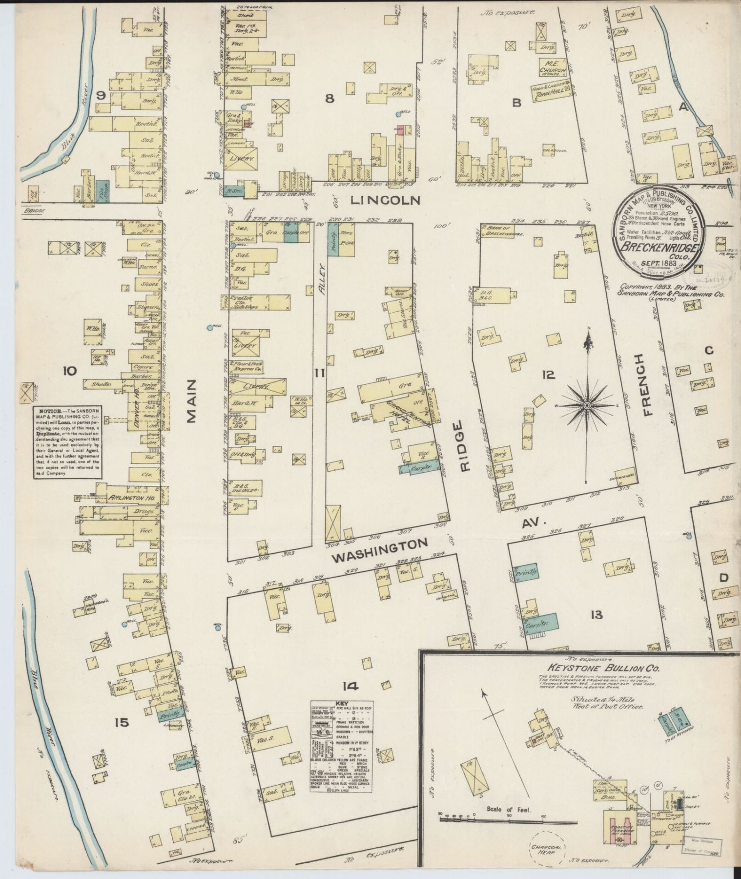
Land speculators, who planned to make their fortunes offering building lots for sale, brought the first true organization of streets and alleys to their newly created towns. George E. Spencer and others under the company name of Spencer, Humphreys, McDougal and Wagstaff laid out the town of Breckenridge just a few weeks after the first recorded discovery of gold in the Blue River. Early maps show that town lots overlaid claims such as the Bartlett & Shock, Snyder, Abbett, Silverthorn, Fanny, and Maggie placers.
The grid system for streets prevailed, in the same manner as it did in other mining towns. Whether working on flat or steeply sloping land, speculators and surveyors preferred it because it was easy to place rectangles on a map; its regularity reduced the number of surveying errors; it provided a variety of individual lot arrangements within a single block; and the land division could be done without being on site.
Businesses and residences lined Main Street, the original major street, which paralleled the Blue River. Bayard Taylor in 1866 described the street as having “log houses and signs of boarding,” like the Miner’s Home and Saloon. William Brewer, three years later, wrote that Breckenridge had “a single street of one-story cabins covered with dirt rather than shingles.” He noted primitive accommodations in divided tents advertised as boarding houses. Rankins Hotel had a single sleeping room. Other businesses could be found on Main Street: restaurants, livery stables, assay offices, blacksmiths, and stores selling mining supplies, food, and liquid refreshments.
Wealthier families in a mining town tended to live one block away from the major street at a higher elevation overlooking the rest of the town. By the early 1880s, this was Ridge Street. The newspaper commented that Ridge Street occupied “the highest ground in the place, and views of the mountain scenery and Blue river valley are remarkably fine.” The editor also explained: “The street occupies a central position in the town and is one of the finest drives, as well as a superior location for residences. A large amount of work was done on it during the last season in grading, removing rocks and stumps……” But not only residences lined Ridge Street. He added: “Already one of the leading hotels, a bank, newspaper office, post office, several saloons and business houses have located on it, with the prospect that more will follow.”
As the town grew to the east, a problem arose as a result of surveying building lots on already existing placers. In 1882, F.P. YIngling and P.D. Mickels, owners of the Bonanza placer, extending just north of Lincoln to slightly south of Adams on the east side of Harris and running five blocks east beyond what was then the edge of town, subdivided the placer and notified those on the lots that they must buy, rent, or vacate their home sites. People had bought their lots and built on them not knowing they held invalid deeds. The prices set by Yingling and Mickels seemed exorbitant at a time of generally low real estate prices. Those occupying the land expressed willingness to pay the cost of the lot without improvements. Yingling and Mickels felt that as the true owners, they could set the price. If those living on the land did not want to pay the price, they could leave. Unfortunately, the newspaper did not report the resolution of the two opposing points of view.
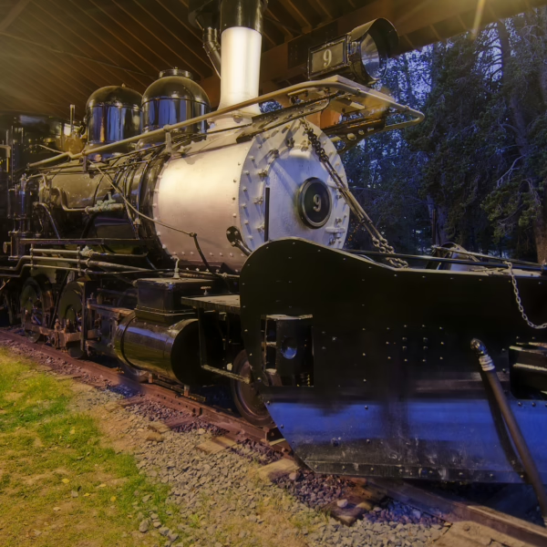
When the railroad arrived in Breckenridge in September, 1883, “west” Breckenridge became important. The trains entered the town on what is now Boreas Pass Road, crossed Main Street to Park Avenue and headed north to Dillon. The railroad built a passenger and freight depot on the west side of the tracks as well as a coaling station. Other enterprises located along the tracks took advantage of the railroad: the electric light plant, a concentrating mill, and a red light district.
By the early- to mid-1880s, the major streets in Breckenridge reflected the true prosperity of the town. Establishments on Main, Ridge and the intersecting cross streets included not only the usual hotels, boarding houses, saloons, general merchandise stores, livery stables, newspaper offices, banks, blacksmith shops, assay offices and transportation depots but specialty stores and shops: the bath house, barber shop, drugstore, confectionary, stationery store, hardware store, bakery, dressmaker and tailor, boot and shoe dealer, contractors and builders, music hall, furniture store, photographer, painter, museum, laundries and law offices, even though lawyers were generally unwanted and considered quite unnecessary.
The grid system still identifies the original streets of the Historic District of Breckenridge. Main Street retains its primary business role; Ridge Street offers magnificent views of the Ten Mile Range. Much has changed along those streets, though. The businesses reflecting the mining economy have been replaced by businesses based on the recreational economy dependent on white gold (snow). And the streets themselves that surround the original grid? They now respond to topographic features rather than march across the land in the regular intervals of the grid pattern.
written by Sandra F. Mather, PhD


